Road closure at Petrified Forest National Park to last through March
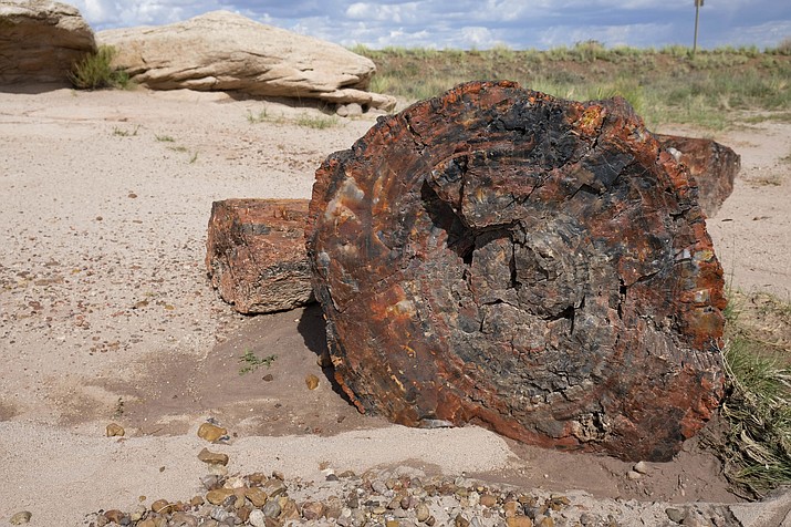
Road closures are currently in place at Petrified Forest National Park east of Holbrook and Winslow. The closures will be in effect through March 28. (Loretta McKenney/NHO)
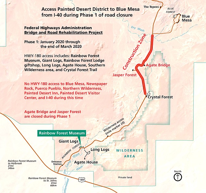
PETRIFIED FOREST, Ariz. – In collaboration with Federal Highways Administration, Petrified Forest National Park will be providing much needed maintenance on a large section of the park road and several bridges in the park.
The closure is expected last from Jan. 2 through March 28 (subject to change due to inclement weather). Once the road is open work may continue through June with traffic delays no longer than 15 minutes. The road closure starts south of the Blue Mesa Loop and north of the Crystal Forest trail area. Areas closed during this time include: Agate Bridge Overlook Jasper Forest overlook.
How to visit the park
During the road closure, the park is split into two regions. The northern region is only accessed from I-40 and contains the majority of Painted Desert overlooks. The southern region is only accessed from Highway 180 and contains the petrified log field trails and Late Triassic exhibits.
Entering the park from I-40
The following locations are accessible from Interstate 40, exit 311:
All distances are from the Painted Desert Visitor Center Painted Desert Visitor Center, Painted Desert Oasis giftshop and cafe gas station.
Tawa Trail
Tiponi Point (0.7 miles / 1.1 KM)
Tawa Point (1.6 miles / 2.6 KM)
Painted Desert Rim Trail (1.6 miles / 2.6 KM)
Painted Desert Inn and Kachina Point (2 miles / 3.2 KM)
Painted Desert Wilderness Trailhead (2 miles / 3.2 KM)
Chinde Point (2.5 miles / 4 KM)
Pintado Point (2.7 miles / 4.3 KM)
Nizhoni Point (3.9 miles / 6.3 KM)
Whipple Point (4 miles / 6.4 KM)
Lacey Point (4.5 miles / 7.2 KM)
Route 66 (5.3 miles / 8.5 KM)
Puerco Pueblo (10.8 miles / 17.4 KM)
Newspaper Rock (12 miles / 19.3 KM)
The Teepees (13.9 miles / 22.4 KM)
Blue Mesa Loop Road and Blue Mesa Trail (17.3 miles / 27.8KM)
There is no access to the Rainbow Forest Historical District or HWY-180 from I-40 during the road closure.
Entering the park from Highway 180
The following locations are accessible from Highway 180:
Each location is accessed from within the Rainbow Forest Historical District.
Rainbow Forest Museum
Rainbow Forest Lodge giftshop
Giant Logs Trail
Long Logs and Agate House Trail
Rainbow Forest Wilderness (from Long Logs Trail)
Crystal Forest (5.8 miles / 9.3 KM from Rainbow Forest)
There is no access to the I-40 from HWY-180 during the road closure. More information is available at (928) 524-6228 or visit www.nps.gov/pefo/planyourvisit/road-closures
Information provided by the National Park Service
SUBMIT FEEDBACK
Click Below to: